|
 |
This site uses cookies - see our privacy policy. Ads & links in bold may give us a small payment from the seller, at no cost to the buyer. However, this never affects our views - if we like it, we recommend it.
Walking The Isle of Wight Coastal Path (2024 Guide)
Walking the Isle of Wight coastal path is worth considering if a) you're fit enough to manage 70 miles over a few days and b) you're old enough to appreciate scenery.
Perhaps I'm being unfair, but I had absolutely no interest in views, scenery and picturesque landscapes until I was at least 20, so I personally wouldn't waste your time dragging a reluctant teenager on a week long walk (are you reading this, mother?)
The walking route hugs the coastline more closely than the official round the Isle of Wight cycling route so two legs do tend to offer better views than two wheels.
This is a long blog post which shouldn't be attempted on a light lunch. You may like to jump to the relevant section:
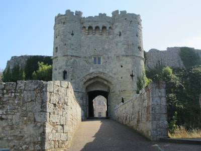
The Isle of Wight Coastal Path is about 70 miles (yes, I know this photo is wonky)
|
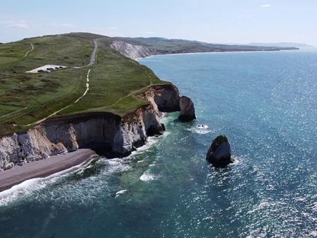
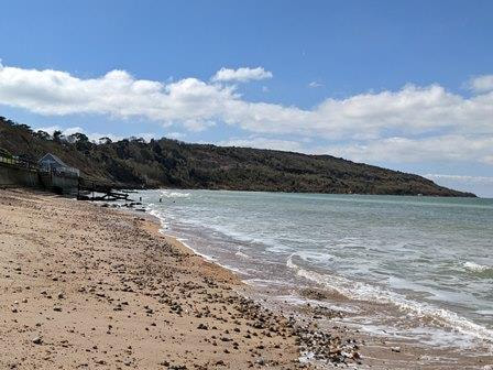
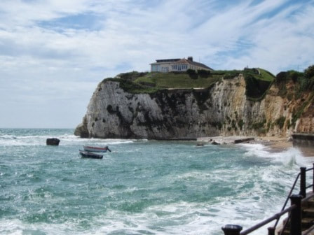
The section around Freshwater Bay is one of my favourite bits of the coastal path
|
How long does it take to walk the Isle of Wight coastal path?
The Isle of Wight coastal path is about 70 miles. You can obviously walk it in a couple of days if you're a lunatic, or you can take a month doing it if you really want to, but bear in mind that some parts of the route are very rural so don't have many accommodation options.
OPTION 1: THE ISLE OF WIGHT COASTAL PATH OVER FOUR DAYS
One company, Contours, suggests a route over 4 days, with walks of 17 - 20 miles. This is an ideal option if you fancy a challenge rather than a sauntering holiday. The Isle of Wight coastline is not especially hilly apart from some bits around the West and South points.
The four day anticlockwise option stops at:
The four day anticlockwise option stops at:
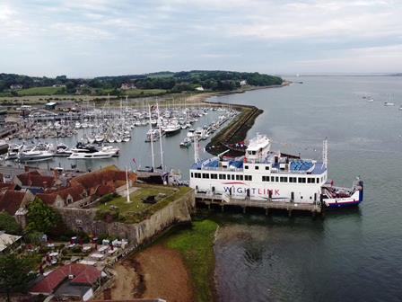
- Ryde. You can start from Wightlink's ferry port on Ryde Pierhead or the Hovercraft on Ryde Esplanade (see our ferry guide). If you want a night in Ryde first then try Royal Esplanade Hotel, Travelodge Ryde or Ryde Castle Hotel (see our guide to Ryde's hotels).
- Shalfleet. It's very hard to find one-night accommodation in Shalfleet, but there's a basic campsite called Camp Wight or a nice B&B about one mile away called Old Ningwood Station.
- Freshwater Bay. There's a small number of B&Bs in Freshwater Bay including Tollgate Cottages, Stroud House and The Bay. The big hotel in Freshwater Bay - The Albion - is currently being redeveloped (as of late 2023).
- Ventnor. Hotels and B&Bs are plentiful in Ventnor. I would start with The Royal Hotel (posh), The Hambrough (also posh) or St Maur guest house. See our Ventnor hotels guide.
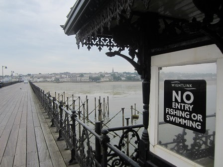
Pier we go! Ryde Pier is a popular starting point if you want to do the coastal path in four days
|
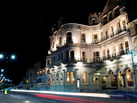
Ryde Esplanade Hotel is a convenient stopping point for one night
|
Option 2: The Isle of Wight coastal path over six days
The Official Tourism people have produced handy PDFs with walking routes with a route over 6 days. Daily walks range from 8 to 16 miles in an anticlockwise route. This is closer to a holiday kind of pace, with some long days and some short days.
You can start from Cowes, Yarmouth or Ryde as they all have ferry ports.
It includes stops in:
The only slight snag is that there isn't very much one-night accommodation in Brighstone or Niton as they are very sleepy (but pretty) places. So you can either camp, or take what's available.
You can start from Cowes, Yarmouth or Ryde as they all have ferry ports.
It includes stops in:
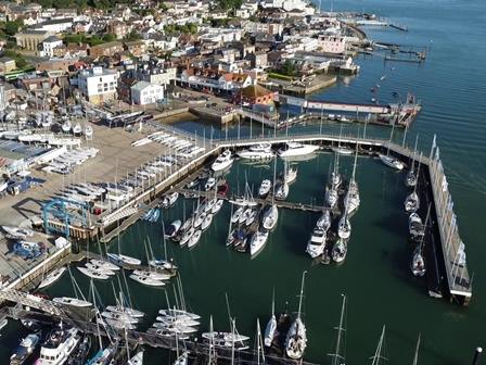
- Cowes. There are several hotels and guest houses in Cowes. I would start with Best Western's New Holmwood Hotel, Villa Rothsay or The Caledon. More options are in our Cowes accommodation guide.
- Yarmouth. There's a reasonable choice of hotels and B&Bs in Yarmouth including The George (posh), The Bugle Inn and Jireh House.
- Brighstone. The Three Bishops is a popular choice for one-night stays. Campsites include Grange Farm.
- Niton. The White Lion in Niton or The Wight Mouse in nearby Chale are good options.
- Sandown. Lots of choices of hotels and guest houses including Premier Inn, Chaston Manor Hotel and The Wight Hotel. See more on our guide to Sandown accommodation.
- Ryde. Plenty of hotels and guest houses which allow one night stays including Royal Esplanade Hotel, Travelodge Ryde or Ryde Castle Hotel.
The only slight snag is that there isn't very much one-night accommodation in Brighstone or Niton as they are very sleepy (but pretty) places. So you can either camp, or take what's available.
Cowes is known for sailing and is a good place to start the six day walk
|
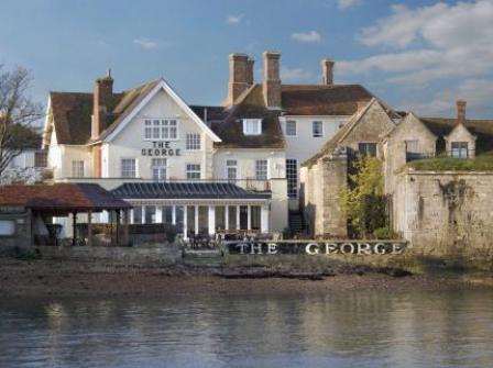
The George in Yarmouth is one of the Isle of Wight's posher hotels
|
Option 3: The Isle of Wight coastal path over 7 days
This is a more leisurely option for those who want to have the time to sit on benches with sea views eating squashed sandwiches for hours on end.
You can start from Wightlink's ferry port on Ryde Pierhead or from Cowes.
This one is also anticlockwise and includes walks ranging from 8 to 11 miles with stops at:
You can start from Wightlink's ferry port on Ryde Pierhead or from Cowes.
This one is also anticlockwise and includes walks ranging from 8 to 11 miles with stops at:
- Ryde. Plenty of choice for overnight stays including Royal Esplanade Hotel, Travelodge Ryde and Ryde Castle Hotel.
- Cowes. Plenty of choice for one night visits including Best Western's New Holmwood Hotel, Villa Rothsay or The Caledon.
- Shalfleet. Hardly any choice of overnight accommodation! Try the Old Ningwood Station, which about a mile away.
- Totland. Again, not much choice but The Highdown Inn and Sentry Mead offer one night stays.
- Brighstone. Yet again, not much choice but try The Three Bishops.
- Chale. Guess what? There's not much choice here either. The Wight Mouse is the main one.
- Sandown. Plenty of choice. I would start with Premier Inn, Chaston Manor Hotel and The Wight Hotel or our Sandown accommodation guide.
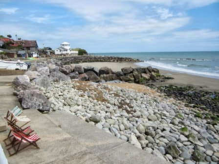
Totland is a lovely place to stop overnight (and it's not usually very busy)
|

The Premier Inn on Sandown seafront is convenient for a one-night stay
|
Should I stay in one place or walk on each day to do the Isle of Wight coastal path?
The more romantic approach is staying in a different hotel or B&B every night along the Isle of Wight coastal path. You can find some suggested links above. There's a company which will move your bags for you called Move My Bags. I've never used them but the handful of reviews are positive.
However, you may decide it is simpler to stay in one place and then take a bus or taxi each day to your starting point. This gives you a much bigger choice of accommodation and means you won't have to bother transporting bags with you. On the downside, it does mean that you will spend time on the bus or in a taxi each day (we will calculate travel times further down the page).
Some people would probably suggest that you stay in Newport, near to the bus station. There's some logic to this as it's in the middle of the Isle of Wight. However, I would only recommend staying near Newport bus station if you really love Sports Direct, McDonalds and vaping teenagers.
Personally, I would stay in a nice holiday cottage with a sea view at a convenient start/finish point for the walk. That way, you can have two days of not requiring as much travel time and you can return each evening to a nice sea view and a coastal restaurant.
The best place to stay depends on how many miles you want to walk each day:
- the four-day trek of the Isle of Wight coastal paths mentioned earlier requires a whopping 17-20 miles a day. You'll stop at Ryde, Shalfleet, Freshwater Bay and Ventnor. I would suggest you look for a holiday cottage in Freshwater Bay or Ventnor. Ventnor also has a good choice of hotels if you prefer that option. Ryde is a large town but it's not as charming as Ventnor, whilst Shalfleet is very small so won't offer much choice. You might even like to stay in our holiday apartment in Freshwater Bay (Ed: subtle plug, very nice).
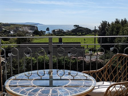
Our apartment in Freshwater Bay has sea views, parking and (most importantly) Wi-Fi
- the six-day walk mentioned above is the route suggested by Visit Isle of Wight. It ranges from 8-16 miles and stops in Cowes, Yarmouth, Brighstone, Niton, Sandown and Ryde. You could find a decent holiday home in any of those places but Cowes probably has the biggest choice (search here for holiday homes in Cowes or see our top 10).
Cowes is a yachty town with some nice restaurants. Yarmouth is a lovely little town, but the choice of holiday homes is a bit limited (there are a few Yarmouth holiday homes here). Sandown has lots of good places to stay. Some parts of Sandown are nice and the beach is sandy, but some parts of Sandown are a bit run down at the moment. Niton is a remote part of the Isle of Wight with rocky beaches which you will usually have to yourself. Brighstone is a large village with pretty thatched cottages - but it's not right by the sea (search holiday homes in Brighstone). If you prefer a hotel, your best bet is Cowes or Yarmouth.
Yachty Cowes is a good place to base yourself for a six-day walk
- Finally, a seven-day walk along the coastal path can be achieved by walking 8-11 miles per day (this is more my sort of holiday..). That includes stops in Ryde, Cowes, Shalfleet, Totland, Brighstone, Chale and Sandown.
As above, you could find holiday apartments in most of those places but I would start with holiday homes in Cowes. Shalfleet (West Wight) Totland (West Wight) and Chale (South Wight) are quite small. You will find the odd holiday home if you look at the map view on HolidayCottages.co.uk.
Brighstone is a good option if you aren't fixed on getting a sea view (it's about half a mile inland). Ryde and Sandown have plenty of places to stay but there are nice bits and less nice bits to both towns.
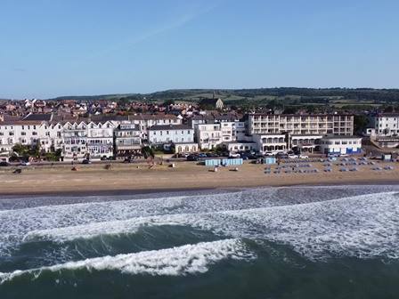
Some parts of Sandown need a bit of TLC but the beach is lovely and some of the accommodation is good
How much time will I spend on buses if I stay in one place?
I won't attempt to figure it out for every option (I'm currently sat in the M&S café and my expensive cappuccino has nearly run out). However, if you were to do Visit Isle of Wight's six day option and stayed in Cowes then it would work out like this:
As you can see, taxis are a lot quicker and take about 30 minutes per day (with return journeys on four days). However, taxis are likely to be more expensive. See our guide to public transport for advice on how much buses and taxis cost on the Isle of Wight.
During the warmer months there are some open top buses that transform a bus journey from a tedious exercise into a pleasant sightseeing experience. There's also a useful 'Island Coaster' bus that follows a circular route. It is popular with walkers but that particular bus isn't an open top bus.
- Day one - Cowes to Yarmouth - 30 minute taxi back to Cowes or one hour on the bus
- Day two - Yarmouth to Brighstone - 30 minute taxi/one hour bus in the morning, followed by 25 minute taxi/55 minute bus
- Day three - Brighstone to Niton - 30 minute taxi/one hour bus in the morning, 30 minute taxi/1 hour 45 minute bus in the evening (no, really).
- Day four - Niton to Sandown - 30 minute taxi/1 hour 45 minute bus in the morning, 30 minute taxi/1 hour 40 minute bus in the evening
- Day five - Sandown to Ryde - 30 minute taxi/1 hour 40 minute bus in the morning, 30 minute taxi in the morning, 1 hour bus in the evening
- Day six - Ryde to Cowes - 30 minute taxi/1 hour bus in the evening
As you can see, taxis are a lot quicker and take about 30 minutes per day (with return journeys on four days). However, taxis are likely to be more expensive. See our guide to public transport for advice on how much buses and taxis cost on the Isle of Wight.
During the warmer months there are some open top buses that transform a bus journey from a tedious exercise into a pleasant sightseeing experience. There's also a useful 'Island Coaster' bus that follows a circular route. It is popular with walkers but that particular bus isn't an open top bus.
Guide Books and maps about the Isle of Wight coastal path
|
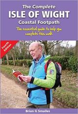
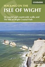
Besides the official anticlockwise route from Visit Isle of Wight there are a couple of books which tackle the Isle of Wight coastal path in a clockwise direction. They are by Brian G Smailes and Paul Curtis and they get similar review scores. I can't help feeling that Brian looks like he's lost on the front of his own book.
|
|
|
|
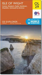
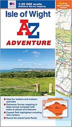
If you want a map for walking the coastal path then I’d either go for the OS Explorer map or the A-Z Adventure Atlas. The latter uses the same scale but is a little easier to handle whilst on a windy cliff edge. It uses OS maps in a book format and highlights the Isle of Wight coastal path. If the weather forecast is for seven days of rain then I’d get the all weather version of the OS Explorer map (or just postpone your holiday).
|
|
|
Day by Day guide to the Isle of Wight Coastal Path
Here's my summary of the 6 day Isle of Wight coastal path guide from the Official Tourism people. I'll link directly to them along with my advice on what to expect. This route is anticlockwise.
Day 1 - Cowes to Yarmouth (16 miles)
This leg tackles the North West coast of the Isle of Wight. It is pretty sleepy, even by Isle of Wight standards of snooziness. There are very few houses or substantial roads and there are also not that many accessible beaches. Ask an Islander to talk about the last time they went to the area and most of them will give you a blank look.
It is, however, very pretty. A big chunk of it is Newtown Creek with its weird Town Hall despite not having a town (see our guide to historic attractions for more details).
It is, however, very pretty. A big chunk of it is Newtown Creek with its weird Town Hall despite not having a town (see our guide to historic attractions for more details).
Yarmouth itself is a lovely little sailing town (and quite posh). There are enough places to sleep and eat to give you a choice and there's a little castle by the pier.
- Cowes accommodation includes Best Western's New Holmwood Hotel, Villa Rothsay or The Caledon or see our guide to places to stay in Cowes
- Yarmouth accommodation includes The George (posh), The Bugle Inn and Jireh House.
- I'm not aware of any campsites in Yarmouth but Camp Wight is along the route.
Yarmouth has a seaside castle and a ferry crossing which connects with Lymington
|
The walk between Cowes and Gurnard is good for yacht watching
|
Day 2 - Yarmouth to Brighstone (14 miles)
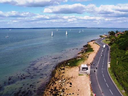
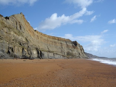
This is probably my favourite section of the Isle of Wight as it is largely 'unspoilt' by which I mean that your peace and quiet won't be broken by clanging amusement arcades. Well, that's not quite true - the section around Alum Bay and The Needles is full of such things, but the walk from the Needles towards Brook and Brighstone is gorgeous with really nice high cliffs looking down on sandy beaches (read our blog).
It's a very rural area, so there isn't a great deal of choice of places to stay or eat, and there's zero nightlife. You'll find a pub inland a little bit at Brighstone but the choice is limited.
Take a look at some of the campsites in the West Wight or stay at The Three Bishops in Brighstone.
Download the official PDF route from Visit Isle of Wight
Fun and games at Compton Bay
|
Crashing waves at Freshwater Bay
|
Day 3 - Brighstone to Niton (8 miles)
The planners of this route decide to give you a nice easy day today. It's another lovely stretch of unspoilt coastline without a great deal of people to get in the way. Some of the coastline - like Whale Chine - is difficult to get to thanks to landslides and the like.
Again, you'll find that there isn't a huge amount of choice of where to stay or eat in Niton (which makes me wonder why it's a suggested stop off point), but it is a lovely area with an olde worlde feeling.
There aren't many places to stay but The White Lion in Niton is the obvious choice. The Wight Mouse in Chale isn't far off course.
Download the official PDF route from Visit Isle of Wight
Whale Chine is one of the hardest to reach beaches
|
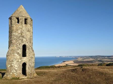
The Pepperpot overlooks the coastline near Niton
|
Day 4 - Niton to Sandown (9 miles)
This is a busy stretch of coastline that takes in three of the Isle of Wight's most famous seaside resorts - Ventnor, Sandown and Shanklin.
The first half of the walk wanders through the olde worlde South Wight which has the feeling that time stopped about a century ago. Ventnor Esplanade is a good spot to stop for something to eat. You'll pass St. Catherine's Lighthouse, which is closed to the public now but is impressive nonetheless.
Sandown and Shanklin are pleasant bucket and spade-type resorts with lots of hotels, guest houses and counters selling chips and ice cream.
Your best bet is a Sandown hotel such as Premier Inn, Chaston Manor Hotel and The Wight Hotel or try our camping guide.
Download the official PDF route from Visit Isle of Wight
The coastal walk from Ventnor to Steephill Cove (pictured) is one of my favourites
|
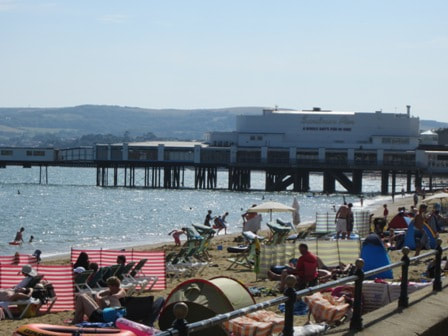
The coastal walk along Sandown seafront is a good place to pick up a cone of chips
|
Day 5 - Sandown to Ryde (12 miles)
There are some really attractive beaches along the Sandown to Ryde route, most of which have shallower water than the West Wight.
St Helens, Bembridge, Whitecliff Bay and Priory Bay are all popular spots with holidaymakers although not quite as hectic as Sandown and Shanklin.
Bembridge has a huge great lifeboat station on stilts, which is free to visit.
I would look for one-night accommodation in Ryde at Ryde Castle Hotel, Royal Esplanade Hotel or Travelodge Ryde.
Download the official PDF route from Visit Isle of Wight
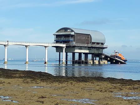
Bembridge lifeboat station is a nice detour on the coastal path
|
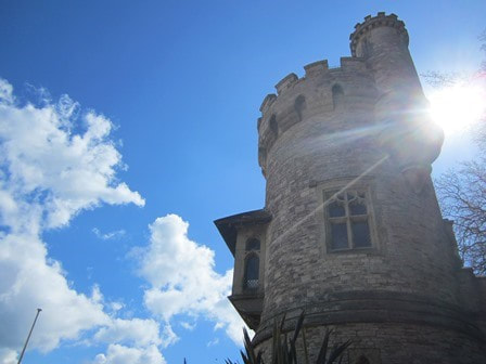
Appley Tower on the seafront in Ryde is hard to miss
|
Day 6 - Ryde to Cowes (8 miles)
Considering it's called a 'Coastal Walk' this day does spend a curiously long time away from the coast. My suspicion is that this is because some of the coastline is privately owned by people who would shout things like 'Gerofff my land!' at you whilst waving a musket.
You can also see from the ferry as you approach the north east coastline that there often isn't a great deal of beach available to walk along.
Queen Victoria's Osborne Bay is en route and is a pretty little beach where her madge used to be wheeled into the sea in her bathing hut. However - it's only accessible if you pay the entrance fee for Osborne House (free for English Heritage members).
The Ryde to Cowes route does have some nice features though, passing over Wootton Bridge, near Quarr Abbey and Osborne House and through some woodland. Quarr Abbey is a monastery with a café.
Personally, I'd say this is the least interesting section of the Isle of Wight coastal path. I'm sure others would disagree. One option is to arrive at the ferry at Cowes and depart from the ferry at Ryde, which would miss out this part altogether. This option is not recommended for anyone with vaguely completest tendencies...
You can find one night accommodation in Cowes at Villa Rothsay, Best Western's New Holmwood Hotel and The Caledon. Our Cowes accommodation guide has more options. There are also Cowes (ish) camping and caravans from Parkdean Resorts or in our camping guide.
Download the official PDF route from Visit Isle of Wight
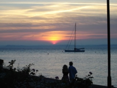
A couple of lovebirds on Cowes seafront
|

Osborne House is a prominent feature in this part of the Isle of Wight
|
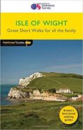
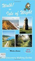
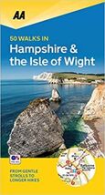
Books of walks on the Isle of Wight
If you've gone off the idea of the coastal path, check out our 10 favourite circular Isle of Wight walks of 3-9 miles....or buy yourself a book of short and not so short walks which don't just stick to the coastal path:
|
|
|
|
|
|
|
|
|
Good sources of walking routes that you can download for free are also available from:
Suggestions for family friendly short walks can be found in our guide to the 10 best Isle of Wight walks of about one mile.
Suggestions for family friendly short walks can be found in our guide to the 10 best Isle of Wight walks of about one mile.